The creep of political polarization has been incremental in the past decade or so on both sides of the border between Canada and the United States. But that’s changed, particularly in America, where what was once a stream has now turned into a torrent.
People are moving, something people have always done, usually in pursuit of education, economic dreams, opportunities, or their dream geography. But now, when people pick up and relocate, it’s often for political reasons.
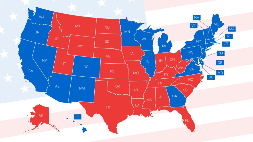
People who identify as red (Republican) are moving to red states, while people who are blue (Democrat) are relocating to blue states.
It’s entirely understandable for people to want to live in an atmosphere accepting, and even conducive, of their political values. Being comfortable in one’s own neighbourhood and community is not a bad thing. When a lot of people do it though, communities lose their balance, and democracy is the less for it. The process ghetto-izes the map, with like-minded people of one persuasion all gathered together in one spot, while those of a different political mindset gravitating to another.
Especially in the United States, government in individual states is often dominated, top to bottom, by one party or another. Super majorities exist in many states where an overwhelming majority of one party can veto the governor, but that’s not often the case, as governors more often than not belong to the same political party as the majority in the legislature. This leads to designations where some states are known as red states (Republican) or blue states (Democrat).
The danger, of course, is the continued and enhanced polarization of some states versus the same polarization of other states. Given the states’ constitutional rights versus the federal government, this process creates a dangerous patchwork of us versus them jurisdictions across the country, each existing as veritable mini-sovereign states.
It’s the kind of thing that starts wars, something the Americans ought to know better than anyone, having experienced two civil wars already in their 247-year existence as a nation.
If you look at a map of the United States just prior to the last civil war, from 1861-1865, then view it juxtaposed with a map of 2023 with red versus blue, indicated, you can clearly see the uncanny resemblance of the two maps, save for the larger number of states owing to territories joining the union since 1865. And even with those relatively new states, one can clearly see the delineation between red and blue.
I have identified the parties I view as being the chief culprits behind this dangerous polarization, but for once I’ll just point to the problem and let the reader assign blame. Personally, I have no vested interest other than to hope for stability in my nation’s immediate neighbour. I also need a healthy and strong democracy on my doorstep to be the leader of the free world, present and accounted for every time an authoritarian demagogue tries to over-reach on the world stage.
Instead, I watch the place unravel from within, propelled by the loudest and angriest voices, voices willing to create a crisis in democracy that only they, with their heavy-handed tactics, can solve. It’s been part of the playbook of communist and fascist regimes for a long time, and it works, that is before it inevitably crumbles, sometimes after the loss of millions of lives.
History teaches, but it seems we never learn.
UNITED STATES 1861

2023 POLITICAL POLARIZATION