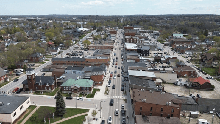
One agenda item for Tuesday evening’s Renfrew Town Council Meeting is the formal introduction of the town’s Master Transportation Plan, a roadmap into the future development of Renfrew’s transportation network as the town grows over the next twenty to thirty years.
Organized around short, medium, and long-term time frames, the plan includes a series of maps/diagrams that display some of the transportation options being looked at. Those maps and diagrams are provided below in the gallery, while the presentation documents are located in full at the bottom of the page.
It’s not my intention here to re-write an already well-written document. BT Engineering, the engineering consultancy group preparing the document, has done a really good job of explaining the underpinning rationale behind their ideas, their scientific methodology, and taking into account the wide array of factors that need to be considered before moving forward with projects that are inextricably linked, as the short term transitions to the medium term, then the medium to the long.
There’s a lot in the document to capture a person’s attention. How about three new bridges crossing the Bonnechere River, including one that will serve as a replacement for the current Bridge Street structure that has a shelf-life and best-before date approaching within the next decade? One of these bridges will be to the northwest of that structure, and be part of an arterial (main or more-heavily used) road that will connect Highways 132 and 60. The third bridge will cross the river to the southeast and make a connection to Bruce Street near the town’s northern boundary.
Speaking of arterial roads, how about one linking Highway 132 to Pucker Street, then incorporated into Lime Kiln Road ( I know that’s Horton Township, but the province is involved in a lot of this, so relax) to eventually link up with the new Highway 417 interchange at the Gillan Road entry/exit?
Would a solution to what is known as Confusion Corner interest anyone? Extensions to Hall Street and O’Brien Road? What if the Raglan Street South approach to Confusion Corner were to be closed, to be replaced by another configuration that has that part of Raglan diverted to meet Veterans’ Memorial Boulevard somewhere just to the northwest of the Renfrew Fairgrounds?
You know how Lochiel and Bridge Streets meet today? What if that were to change? And the new bridge to replace the existing bridge? How about the new bridge being aligned differently and on a different grade/elevation? My apologies at not being an engineer, so my description of this last point might not be exact, but it sort of gets to heart of the matter, at least I think.
Traffic circles or round-abouts, whatever your term of choice, to ensure traffic flow through the community and to serve as a traffic conduit should the main highway ever be shut down due to emergency. Again, there would be provincial input on this given that many intersections are part of a provincial/county/town roadway combination of responsibility.
A northbound left-turn lane at Raglan and Renfrew Avenue.
Sidewalks and multiple use pathways. Incorporation of the two main trail systems, the Algonquin and Millenium.
A truck route to get the big rigs off the main drag. And the tractors and forklifts and any BEI guys going for a lunchtime main-drag cruise in their front-end loaders.
All we’re missing is a designated lane for people with modified/no mufflers and shit-beater pick-up trucks, but you can’t think of everything.
All of this is a broader part of an over-all plan that includes the development of the Renfrew East area, a plan I discussed a couple of weeks back or so and accessible through the provided link via the photograph on the left.

The plan envisions a Renfrew growing to a possible population of 15,000 over the course of the plan’s timeframe. I think 15,000 is a somewhat conservative estimate, but I’m not an engineer, and at best would be an extremely amateur geography hobbyist, so I’m more than happy to accept their numbers on this.
When you look at the first map involving growth areas in the community, you can begin to picture the need for all of this moving forward, and how much this community will change from the one we’re so familiar with today.
This is not an exercise in fantasy, by any means. Anyone who’s been around this community for the last several decades would be able to identify easily all the changes that have taken place over that time. After all, change is inevitable, and necessary. but there have always been structural things that have always seemed to endure, like that Confusion Corner situation for an example. While a cute little signature piece of Renfrew’s identity, that intersection is an absolute nightmare, and, while perhaps quaint in the annals of Renfrew folklore, it’s a ready-made disaster which would only be exacerbated by the influx of non-local traffic that will pass by that spot as a result of increased tourism and increased growth. An anachronism whose time has come.
As to the town and BTE, a lot of feedback was sought out, received, and considered, with almost all aspects of that feedback being built into the rationale behind the proposed plan. Again, I’ll let the engineers do the explaining, which they do in an easily understood manner, a refreshing change from a lot of documents that are wrapped inside of indecipherable professional jargon. All terms are self-evident or easily figured-out, and the maps and diagrams have an inherent clarity in them as well.
Taken together, the lists and maps tell an interesting story of how Renfrew’s transportation needs will respond to the growth that’s coming our way.


