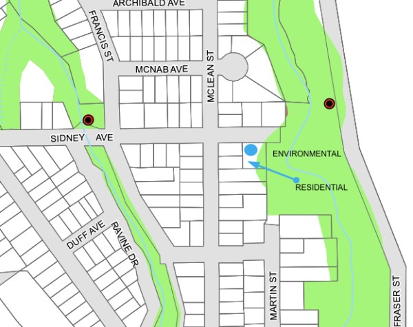
So there’s this property at the end of Sidney Avenue, owned in common by the owner of 253 Mclean Street, and now being considered for the construction of a home.
On the Official Plan for the town, the property is shown as being zoned for residential. But on another environmental plan, part of the property falls within the boundaries of an area designated as being a natural hazard zone, as there’s a ravine situated right next to the property, and the property itself contains a negative slope leading down to this ravine. The lot, then, gets caught in a municipal Venn diagram, with overlap of two different designations.
Continue reading “SIDNEY AVENUE LOT DESIGNATION UNDER REVIEW”